
In the last three
weeks the northeast monsoon has brought Chennai and its surrounding districts a
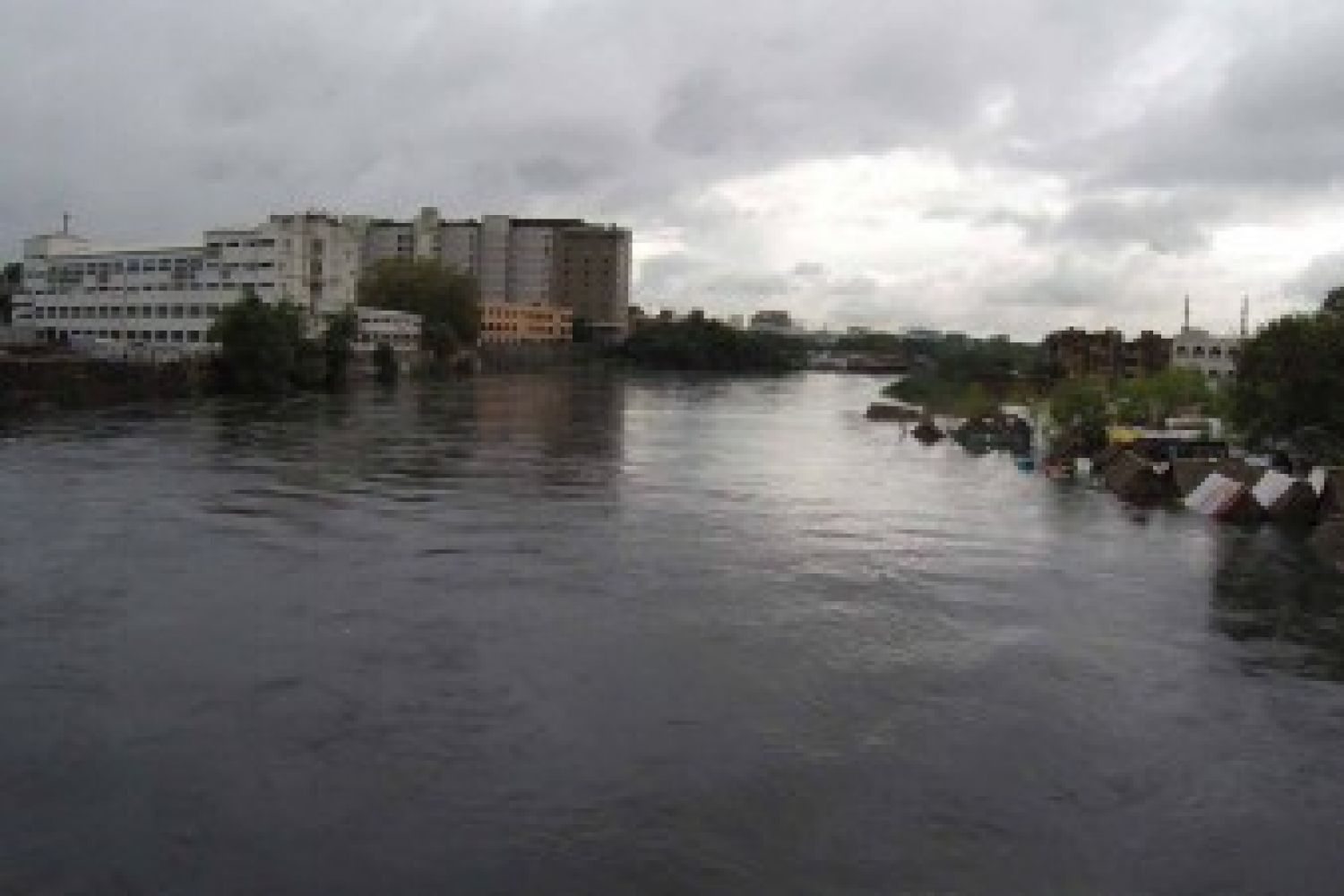
deluge of biblical proportions in several phases. The result was catastrophic
for Chennai and neighbouring districts of South Arcot (especially Cuddalore
town), Tiruvallur, Kancheepuram, Villupuram, Tirunelveli, and others. The full
extent of the misery wrought by the rain will become clear only in coming days
but the bare figures for precipitation should give an idea. On December 1-2,
the southern suburb of Tambaram had some 45 cm of rain, Chennai city itself
recorded 30 cm and Cuddalore some 40 cm. This was in addition to the earlier
precipitation that nearly drowned the state twice in November, a fact that went
unrecorded by the national media.
Chennai city and its
suburbs are like a vast lake dotted with patches of dry land. Lakhs of people
are still marooned three days after the worst passed, the Adyar and Cooum
rivers burst their banks under the pressure of draining all the waters passing
through their catchment areas, advancing on adjoining colonies like a tidal
front.The city is at virtual standstill, with offices closed, schools closed,
and thousands of people hunkering down in makeshift shelters. Industry has
suffered a devastating blow, train services are patchy and the airport is
closed. Bus transport was severely affected.
Some areas had no
power for over three days, and increasingly desperate people in the inundated
areas prayed for rescue even as they watched their drinking water run out,
mobile phones go dead while the flood waters kept rising. For the record
conscious it’s been a season of joy. The monsoon has broken virtually all
previous records, with 119.73 cm in Chennai till the night of December 2.
The monsoon extended
into southern Andhra Pradesh as well, the massive precipitation swelling
obscure little streams into mighty torrents and flooding the coastal districts
of Chittoor and Nellore.
People say they
haven’t seen anything like it in their lifetime. Much before people could wrap
their heads around the scale of the phenomenon, scientists of the Indian
Meteorological Department(IMD)—at Pune and Chennai—were seeing that in the
coloured satellite images that crawled up their screens.
“This is pure active
northeast monsoon with a feeble trough of low pressure with a little bit of
extension in the upper layers of the atmosphere,” says S. B. Thampi, deputy
director general of meteorology, Regional Meteorological Centre, Chennai.
The major factor, he
says, is “sustained velocity convergence”. That is, the wind off the Bay of
Bengal grabs moisture above the Bay, barrels up to 40 to 50 kilometres per hour
(kmph) and hurls itself at the land, kind of suffocates itself due to friction
and retardation, rises up, which causes forced convection, then cools and
condenses, and drops down in blinding sheets of rain.
“Whenever you have a
trough of low pressure being stationary along the coast, it’s bound to generate
lots of rain," says Dr S. R. Ramanan, director of the Area Cyclone Warning
Centre at Regional Meteorological Centre, Chennai.
When intense systems
such as tropical cyclones and depressions roll over, they move fast. But this
is a weak system. “Weak systems linger for a longer time and they are rain
makers,” he adds.
IMD experts say this
is not unprecedented. They point to 45.2 cm of rain on November 25, 1976;
about 26.1 cm on one day in December 1918. In the last three weeks, according
to the IMD, there was a deep depression between November 8 -10, and a low
pressure area between November 13-18, which generated lots of rain.
Weather being a dynamic
system, Thampi says, “If you take the long-term average, it will have
variations statistically, peaks and lulls, standard deviations, and second
standard deviations.”
But these changes are
not happening in a vacuum. Rising temperatures generate greater quantities of
water vapour which has to find a way down to the surface.Local factors such as
urbanisation (and urban heat island effect), lake-and-marsh encroachment,
construction in low-lying areas, and high population density all add to the
underlying conditions. In addition, global factors of a strong El Niño-Southern
Oscillation (ENSO) and possible climate change also could be part of the mix.
ENSO is not just a shift in ocean currents that warms up broad stretches of the
Pacific. It is, in the science writer Charles Petit’s explanation, “a sort of
see-saw in atmospheric pressure and trade wind patterns that in turn affects
ocean currents. Its opposite, intense phase is dubbed La Niña.”
El Niño was active in
1918 and that may have contributed to the extreme rainfall (108.8 cm in
November) in Chennai, according to Professor Jayaraman Srinivasan of the Centre
for Atmospheric and Ocean Science (CAOS) at the Indian Institute of Science
(IISc).
“All EL Niño
years do not cause extreme rainfall in Chennai. The rain in November 2005
was not related to El Niño. We do not know why this year's November rainfall
was an all-time record.”
“It’s the Indian
(southwest) monsoon that tends to be weaker during strong El Niño events. The
northeast monsoon tends to be stronger during El Niño,” says Bob Henson, a
meteorologist and blogger for Weather Underground and the author of The
Thinking Person’s Guide to Climate Change.
He says that proved to
be the case in 2015, as most of the country had below average precipitation for
the season. In October and November, only the far south and extreme north of
India received above-average rain.
Chief forecaster at
the International Research Institute for Climate and Society (IRI) at Columbia
University, US, Tony Barnston believes the very warm Indian Ocean, most all of
it, is playing a role in the high rainfall in Chennai. He says it is related
mainly to the nature of this particular El Niño in the Indian Ocean, and
possibly the fact that last year we also had a borderline El Niño, and two El
Niño-ish years in a row could keep the ocean warmer than just one El Niño year.
During El Niño, the
Indian Ocean usually warms, the western portion (near the African coast)
generally more than the rest. This time, most of the Indian Ocean is warmer than
average, including the portion bordering India (for example, the Bay of
Bengal), he explains. “This is likely playing a role.”
It is certain that the
oceans are warming and sea surface temperatures (SSTs) are increasing, which
affect wind circulations.
“El Niño conditions in
the Pacific tend to be followed by high SSTs in the Indian Ocean some three to
five months behind the peak in the Pacific, but this event has been unusual in
that it started in 2014 and hesitated,” says Kevin Trenberth, distinguished senior
scientist in the Climate Analysis Section, National Center for Atmospheric
Research, Boulder, US.
As he explains, there
were signs of an El Niño beginning in January 2014. Some warming occurred and
strongly influenced the 2014 summer, but El Niño faded and did not develop,
until it began again in 2015. Explaining the climate change component, Trenberth
notes that sea surface temperatures are certainly high: over 29°C although only
a bit higher,perhaps 1°C or so than normal.
“It does mean that
there is a lot of moisture in the air lurking around, and sort of waiting to be
gathered up by any storm. So part of this may be the lack of competition
elsewhere. The effect seems to be very local, not big storms, also
generally unsettled weather in the region,” he says.
The Indian Ocean has
warmed more than other oceans, in part because they have a cooling mechanism.
El Niño in the Pacific and the thermohaline circulation in the Atlantic tend to
cool the ocean.
“Above the warm ocean,
the atmosphere becomes very moist: about seven per cent per degree Centigrade.
So that can set the stage for torrential rains with the right disturbance which
reaches out and gathers in all the available moisture.”
“So without a lot of
study,” Trenberth concludes, “my hypothesis would be that climate change has
set the stage, El Nino has further bolstered the odds, and then chance weather
has topped it off with a series of flooding events.”
Title image: Chennai and its suburbs resemble a vast lake dotted with dry patches. Photo courtesy Dinamalar