When Fraser Taylor was doing research in 1970’s in Kenya, he had an experience that gave him a window into the worth of local wisdom. A multi-million dollar aid project to map soils was in the works in one of the districts. Some locals asked Fraser what all these “wazungu” (foreigners) were doing. When Fraser explained, one man picked up a stick and in a few minutes drew a map in the sand showing soil suitability for various crops which was just as accurate (and much cheaper) than the scientific survey.

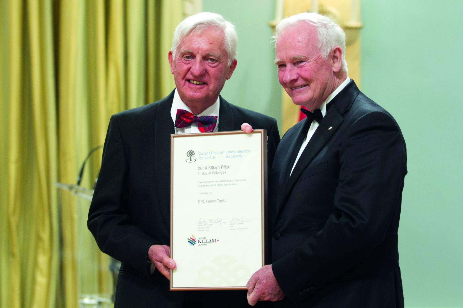
Taylor’s pioneering efforts to document, store and disseminate indigenous knowledge through cybercartography and geo-narratives is the need of the hour as indigenous cultures and their knowledge are being removed from the places they’re rooted in. He was brought up in a small seaside town in Scotland and completed his education at the Universities of Edinburgh and London. His Ph.D.  was on rural development in Kenya, and he completed it while he was also working for the Kenyan government  as an education officer. From 1987 to 1995, Taylor served as the president of the International Cartographic Association and in 2013 he was awarded the Carl Mannerfelt Gold Medal, the highest honour in cartography.

Now, a Chancellor’s Distinguished Research Professor and Director of the Geomatics and Cartographic Research Centre at Carleton University in Canada, Taylor’s current research delves into finding ways of applying geospatial information to the analysis of key socio-economic problems in a national and international context, presenting the results in new cartographic forms. Atlases documenting the life of Inuit and aboriginal people in northern Canada are an innovation in the evolution of cartography.

Cybercartography, the concept Fraser introduced in 1997, presents information in four senses, of which the map is a part. With his collaborators, he developed a software called ‘Nunaliit’, which means community in Inukitut, which allows people to input their information in the  format they want--text, photograph, audio, video, (and experimentally smell and touch). They have experimented with both these senses and although touch is fully operational, they still need to perfect an odour diffuser for smell.

Inuit siku (sea ice) Atlas for instance, presents Inuit knowledge of sea ice (siku) around Baffin Island, Nunavut, in layer upon layer of nuance, of the importance of sea ice for their life of hunting and travelling, of translations of insights of Inuit Elders into the changing geographical phenomena.

For Professor Taylor, each place is a story, a geo-narrative. For the Inuit each journey is a living experience and although they may travel the same route every journey, each journey creates a new story. These geo-narratives capture the essence of the journey.

Fraser is also working with India, China, and Mexico on various aspects of geospatial information management of which cybercartography is a part. His latest book published in 2014—Developments in the Theory and Practice of Cybercartography: Applications and Indigenous Mapping—deals with indigenous mapping.

In a conversation with Fountain Ink, he talks about how to save vanishing languages, tribes, and their wisdom.

How your love for traditional indigenous knowledge has made you what you are.

It taught me that local experience is equally, if not more important, than knowledge gained through formal education and research as well as the importance of listening to local people even if they lack formal education.

What is cybercartography?

Cybercartography can be simply defined as the application of place-based analysis to topics of interest to society in a national and international context and the display of the results in innovative multimedia and multi sensory displays which people can easily understand. It can therefore be applied to many topics. For example we could create a cyber cartographic atlas of the sacred groves in India which would include a wide variety of content including videos. By creating a cybercartographic atlas we can often preserve traditional knowledge which would otherwise disappear.

What is the idea behind cybercartopgraphy?

I have always been interested in the wisdom of local communities and in my work in Africa I developed a concept called "development from within" which emphasised that development is best driven from the bottom up, not the top down. This is the underlying philosophy behind cybercartography, which is aimed at empowering local people.

In your first book on cybercartography, Cybercartography: Theory and Practice, you talk of its three functions: map as a material fact, as cognitive construct, as a social construct.

Maps are artifacts but they also reflect the ontology of those who make them and the societal values they hold. Maps are not objective. They are social and cognitive constructs.

So if you interview someone for the story on lost languages for example we would put a video of that story in our Atlas tied to the place that the story was about or the place where the interview took place or both. All of our Atlases have geo-narratives regardless of what the topic of the Atlas is.

So, we create a geo-narrative of a place and people, and their relationship, using cybercartography. What is a geo-narrative?

Geo-narratives are stories told with place as the identifier for the person telling the story. So if you interview someone for the story on lost languages for example we would put a video of that story in our Atlas tied to the place that the story was about or the place where the interview took place or both. All of our Atlases have geo-narratives regardless of what the topic of the Atlas is. It is also a way to ensure that different perceptions of the same set of  ‘facts’ can be given. On many issues there is no one is equal to ‘right’ or  ‘wrong’ answer, just different interpretations such as that of the government, the bureaucrat, the industrialist, and of course the local people. Our Atlases can give all of these without privileging one over the other giving the user of our Atlas an idea of the complexity and contradictions involved.


How do cybercartography and geo-narrative truly capture the sense of place and of the people?. You capture these things in writing, painting, and in multimedia.

People experience their environment using all of their senses. Cybercartography attempts to duplicate this experience rather than just using vision. People also learn in different ways. Some people like text, others like graphs and statistics, some like watching videos and movies, others prefer to listen to oral descriptions or sound bites, some people like photographs. There are many ways in which information can be displayed. Cybercartography can represent information in many forms allowing people to choose the way they would like information displayed to fit their own learning style. Story telling is central to how people learn and express themselves all over the world regardless of the cultures involved. Cybercartography uses this in innovative ways and ties the story to the person and the location in which they are which is why I use the term geo-narrative.

Please talk about applying cybercartography in Indian context.

I think that cybercartography has great potential to deal with many topics in India, especially at the village level such as disappearing languages in Andhra Pradesh, for example, as well as a variety of other issues of central importance to social and economic development in India.

How does cybercartography help in preserving the dying languages?

Cybercartography helps dying languages by preserving them in oral form through recordings and videos of native speakers telling their own stories in their own languages. These become  ‘living’  archives which are also distributed online to a wide variety of others interested in the topic both in India and globally. The authenticity of the information lies in the  ‘living’ metadata, in other words, the people who are providing the information.

If cybercartography is applied to language we can at least preserve the language concerned in its own context and in the words of the people who speak it. By allowing them, or in fact empowering them, to tell their own stories we can perhaps persuade people in other parts of India that these things are important. We can also use the atlases as a tool in both formal and informal education.

How traditional and local knowledge can be made dynamic?

Cybercartography can make traditional and local knowledge dynamic as you can see by looking at some of our atlases. The Kitikmeot Place Names Atlas, for example, allows Inuit elders to describe the rich features of their territories in their own language. A variety of cybercartographic atlases can be found on our website and a description of the construction of these in Developments of the Theory and Practice of Cybercartography: Applications and Indigenous Mapping.

You said, print is totally inadequate to capture the storytelling traditions? Could you please talk about how the new technology fits well with oral culture.

The Nunaliit Cybercartographic Atlas Framework which is used to create cybercartographic atlases is specifically designed to ingest information in oral form (as well as, of course, in a number of other forms). In primarily oral cultures such as that of the Inuit, which did not involve any written records until relatively recently, this is the only way to capture their stories and narratives. Even today there are Inuit elders who cannot write in the new artificial syllabic script developed relatively recently. In many societies the level of literacy is low. Consequently story telling in oral format is the best way to go.

In what specific ways, association with Inuit people enriched/changed your own scientific endeavor?

It has led to a new appreciation of the significant difference between Inuit ontology “The Inuit Way of Knowledge” and western scientific knowledge and the need to find ways to bring these two approaches together when seeking solutions to societal and environmental problems in Canada’s north.

How can a tribal person without any education transition from ‘map user’ to ‘map creator’? How can cybercartography  be deployed at the location so that they can work on it at their own place and time?

We are designing a distributed database where servers reside in the community so that people without any formal education can make inputs to our system. We have also created an app for the IPad to simplify this. The user interface of our system is specifically designed to allow people with no knowledge of geographic information processing to input information. Our mobile app is being designed to allow people to input information on their cell phones.

This is being used as an educational tool…

The Inuit Sea Ice Atlas is being used in Nunavut schools and the Atlas of Arctic Bay is a central element in a new research methods course at Nunavut Arctic College.

What are the insights you think the scientific community can glean from Inuit elders on climate change, melting of sea ice?

The Inuit are astute observers of the environment in which they live as their lives and survival depend upon these observations. They are much closer to empirical reality than the “objective” western scientist.

Community monitoring of the effects of climate change will provide new insights to help western scientists understand the complex effects of these changes. Actively incorporating Inuit knowledge of the environment with western science will lead to an increased understanding of environmental change and above all of the social and economic impacts of these changes . The Inuit are at the front line of the changing environment and any mitigating strategies must be built on their understanding of local realities or they will not work.

You say that we’re truly entering the Age of Location. Could you please elaborate it, the ‘where’ of us. What does that signify?

Location-based information is now universal. Location-based information and services are central to societies all over the world and are growing in importance exponentially in both economic and social terms.

Think of your cell phone or the GPS in cars for example. Many governments are now organising information using location through what are called spatial data Infrastructures and India is no exception in this respect. The objective is to link information from all ministries by location thus increasing its utility. Industry too is increasingly organising their business using location-based services. The estimates of the economic value of all this location-based activity runs to billions of dollars and is growing exponentially at over 30 per cent per year. We are truly entering the age of location.

Could you talk about your work in India?

India has one of the longest traditions of map making in the world as the Survey of India was founded before the Ordinance Survey in Britain. Since the time I was Vice-President,and then President of the International Cartographic Association I have advised Indian Surveyor Generals on the development of mapping in India and visited the headquarters of the Survey in Dehradun. As Chair of the International Steering Committee for Global Mapping more recently I oversaw India's involvement in Global Map especially the important changes in policies over data sharing which continue to be an important topic in India. More recently India has continued to develop through the Ministry of Science and Technology a Spatial Data Infrastructure and I have been actively involved in these discussions. I have also worked with the Indian private sector on geo-spatial management issues especially with Geospatial Media inc and have participated in several of their international conferences.

How could India use this technology?

India can use geospatial technologies at various scales and on a variety of different topics related to socio-economic development. Cybercartography can perhaps best be used at the village level in India to help involve local people plan their own development. The concept of Development from Within on which  Cybercartography is based owes much to Gandhi’s thinking.


(Published in the July 2016 issue.)