Shijo Joseph is taking an account of water-logged lives in Kerala. A scientist working with GIS and satellite data for the Kerala Forest Research Institute (KFRI), his first brief is a ground survey in the Chalakudy river basin. He is looking for the high water mark left on the walls to measure how far water has risen from the ground up. These “ground control points” help validate satellite-based remote sensing data later.
“The inundation lines are clearly visible on the walls of the buildings where wetness or remnants of flood such as small particles, floating materials are present,” he says. The water level varies from zero (non-inundated areas) to 3.2 metres, more than the height of the ground floor.
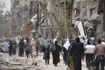
Joseph was not personally affected. His house in Ernakulam district is on higher ground; the waters haven’t entered his office in Thrissur district either. But in the immediate vicinity he sees plenty of signs; places and homes marooned; belongings ruined, furniture ripped, sodden electronic goods, cars and vehicles sloshing in water and keeled over, bleached whales of mud and muck, debris and junk, sprawled in homes in most of the ground and first floors of houses and all over the place. For him, the ground is no longer the ground, it’s a swamp.
With 40 per cent more rainfall than the usual and more than a million people displaced, the death toll may have been much higher than the official 400 but for the helping hand of neighbours. Particularly notable are the fishermen who toiled day and night to rescue people trapped in their houses. Others provided food and shelter to supplement the state government, army and National Disaster Relief Force’s efforts.

Joseph’s understanding is that moisture from the Arabian Sea fuelled the deluge. A massive bank of rain-bearing clouds headed for the Western Ghats, perched on the upper reaches, stalled, condensed and the result was a biblical downpour. He wants, in the near future, maybe in collaboration with the Earth Institute at Columbia University, to find out if this flood is part of the global and regional climate shifts, especially coming after the very severe cyclone Ockhi in 2017.
He feels two local factors drove up the magnitude of the flood. He and his team observed nearly 100 landslides in the upper reaches of the Ghats. Open blasting while quarrying sent tremors through charnockite rock, “shaking the parent material”, and compromising its integrity. When the rain came, the mass became increasingly unstable until it finally slipped down the slopes into river- and stream beds, swelling them further.
The second, he says, is the wholesale destruction of wetlands. Up to 15 per cent of Kerala originally comprised wetlands. They’re being destroyed on a massive scale. Had they been standing, they would have absorbed some of the excess water which would eventually have flowed out to the sea. Even paddy fields usually acted as lakes to trap water, which then would flow out to sea. But in this case, Joseph says, that didn’t happen because the fields were construction sites in the state’s mass conversion to other land uses. These two human activities “exacerbated the floods”.
“Now, we have to worry about water-borne diseases and sanitation,” he says, on the phone, in the midst of sniffles and bouts of coughing. He’s got a viral fever—visiting all those places for the ground survey. They also have to contend with mould spawning on everything moist, making respiratory problems worse. They have to look out for snakes that might have been floating around and sneaked in. For the most part, they have to grapple with themselves first.
***
A
flood is not necessarily over even after the waters recede. They leave marks, sweep away a lifetime’s labour in creating a home, they leave persistent memories—every new downpour brings an intimation of deluge.
India is a sitting duck for extreme events. Flood disasters have become persistent and systemic.
In India, millions of people are exposed to floods every year. Vulnerability to floods and economic risk is among the highest in the world. Drawing upon CWC and NDMA sources, the paper, “Riverine Flood Hazard: Disaster Risk Reduction in India,” which is in press with the Proceedings of the Indian National Science Academy (PINSA), says that the total number of flood deaths between 1953 and 2011 was 97,551, and the economic cost ₹4.506x10¹² at 2017 prices.
Research suggests that with rising global temperatures, there will be a significant increase in the frequency and magnitude of extreme rainfall events during the monsoon. Recent extreme events, including Kerala’s, are testimony to the climate disruption already locked in.
According to Aqueduct Global Flood Analyzer (AGFA 2017, as referenced by the paper) from the World Resources Institute, a “web-based interactive platform which measures river flood impacts by urban damage, affected GDP, and affected population at the country, state, and river basin scale across the globe”, India stands at number one, with 4.48 million people exposed to river floods, followed by Bangladesh with 3.48 million and China with 3.28 million. The cost of GDP from flood risk is $14.3 billion, followed by Bangladesh at $5.4 billion. India’s loss of GDP is 15 per cent of the global total.
According to Central Water Commission (CWC) data for 2010, 18.3 million people were affected by floods. (AGFA takes into account only urban populations while the CWC’s higher figure has both rural and urban populations.) India is thus a sitting duck for extreme events. Flood disasters have become persistent and systemic in India.
***
O
n a larger scale, for Kerala’s floods, there is an analogy of sorts with the catastrophic flooding in Texas, US, last year, from hurricane Harvey. Although each case differs and depends on the storm involved, the Kerala flood has parallels with recent extreme events, including Japan between June 28 and July 9, in which 225 people died and about two million people had to be evacuated.
In their May 2018 paper titled “Hurricane Harvey Links to Ocean Heat Content and Climate Change Adaptation” published in Earth’s Future, Kevin Trenberth, a Distinguished Senior Scientist in the Climate Analysis Section at the National Center for Atmospheric Research (NCAR), Boulder, U.S., and his colleagues show for the first time that “the heat loss by the ocean caused by the storm (evaporation) matched the latent heat in the rainfall”.

“The high ocean heat content (highest on record for calendar year 2017) feeds the high sea surface temperatures (SSTs) that set the stage for large evaporation, atmospheric moisture, and heavy rains,” he explains in an email.
In their work, Trenberth continues, they were able to determine how much moisture evaporated from the ocean by measuring ocean heat loss, and were then able to match that with the heat generated by rainfall.
“So we were able to estimate the evaporated moisture and it matched the independent measurement of rainfall. If the ocean had not been so warm, it would not have evaporated as much and the rain would have been less. Part of the ocean heat was from human effects from global warming,” he says. Although there is no study as yet linking the Kerala floods to high ocean heat content, it’s a fair guess that torrential downpours fed off the heat content of the Indian Ocean.
Floods depend on the behaviour of rivers. Vishwas Shripad Kale, a retired professor from the University of Pune, says the characteristics of Himalayan and peninsular India’s rivers are very different.
In the case of hurricane Harvey, it was also said that the storm took some of the rain it dumped and hurled it back again. Some of the land became so wet that it acted like a water surface and enabled evaporation to occur over what is normally land, Trenberth says. In the case of the Kerala floods too, this could have occurred.
***
F
loods also depend on the characteristics and behaviour of rivers. Vishwas Shripad Kale, a retired professor from the University of Pune, who has done extensive work on river behaviour, flows, flood geomorphology and landscape evolution, says the topographic and climatic characteristics of Himalayan and peninsular India’s rivers are very different.
In the Himalayas, runoff collects quickly. This happens, to some extent, in the Western Ghats as well. But the main peninsular rivers—the Godavari, Krishna, Kaveri—flow over a plateau, while rivers in the Himalayas have less space to spread out on the plains.
As Kale observes, over the Ganga plains (UP and Bihar) and the Punjab plains flood water from Himalayan rivers spreads and lingers longer due to the gentle slope of the riverine plains. In the peninsula, this happens to some extent over the Deccan plateau (Maharashtra and Mysore plateaux), because of gentler valley slopes in comparison with the Western Ghats.
In the monsoon season, cyclones travel across central India, and along their path it rains heavily, triggering floods. Rivers outside their path won’t have large floods.
While rivers like the Ganga change course, peninsular river channels are cut into rock, and are relatively stable. They don’t change course much. In old maps of the Ganga plain, Kale says, you find rivers changed course, shifted or moved out of their beds. These changes are not as pronounced in the peninsular rivers.
Kale speaks of the Kosi shifting almost 100km in 250 years or so until it was contained by embankments in the 1950s. It was thus both unstable and unpredictable. Many rivers in the Ganga plain keep shifting their courses.
The behaviour of rivers is also affected by the spatial and temporal variability of monsoon rains, Kale explains. Spatial variability is simply the regional difference in monsoon rainfall and floods.
For example, the tributaries of the Ganga that originate in the Himalayas carry more water and sediment than tributaries originating in Madhya Pradesh, like the Son and Chambal. The latter originate in relatively lower relief and also there is less rain in MP. They are also tributaries of the Ganga but there is a remarkable difference in behaviour.
In some rivers, the discharge—the amount of water that flows through the river—is very high because they originate in the high rainfall zone (for example, the Western Ghats). In comparison, the Manjra, a big tributary of the Godavari, which originates in the dry Balaghat range of hills near Ahmednagar district of Maharashtra, carries less water than others. If the rivers have large catchment areas, they collect more rainwater, which means bigger floods.
The Godavari has on average greater discharge and its floods are more severe than the Kaveri because the latter has a smaller catchment area.
Temporal variability is the behaviour of a river changing with time, from year-to-year variations in monsoon rainfall and intensity over the catchment. It’s not uniform for all rivers. Some rivers may get flooded and others remain unaffected. A huge flood on the Krishna does not necessarily mean the same on the Narmada or Tapi.
Cyclones are also important. In the monsoon season, cyclones travel across central India, and along their path it rains heavily, triggering floods. Rivers outside their path won’t have large floods.
Size , shape, what’s the relief of the basin, land-use of the basin, forest area, how much water it can retain, where it has wetlands—all these determine floods on the rivers.
“Therefore,” he continues, “there is both spatial variability from one region to the other, and temporal variability, related to time.”
The behaviour of rivers depends on catchment characteristics, the size and shape of it, Kale adds. In the case of the Narmada, it is long, doesn’t have major tributaries so floods mostly happen when it rains at the source. The Narmada’s big floods are caused only by heavy rain in the source area.
In the case of the Godavari, which originates in the Western Ghats, (its tributary Wainganga coming from central India, another, Indravati, from the Eastern Ghats), wherever it rains, it collects water. Even when it’s not raining in the Western Ghats but raining in central India or the Eastern Ghats, it will have floods in the lower reaches.
If basin slopes are gentle, water flows slowly, takes longer to move. In the mountains, it flows fast and run off collects fast. You have flash floods on coastal rivers in the Konkan and Kerala.
“Size , shape, what’s the relief of the basin, land-use of the basin, forest area, how much water it can retain, where it has wetlands—all these determine floods on the rivers,” he says.
Kale also talks about the power of a flood, known as competence. Basically it means how much power it has, to push things, erode things, man-made or natural, to wash away soil, trees and bridges. If the river passes through flat regions with gentle slopes and has a wide channel, it will have low competence.
For example, when the Kaveri is flowing over the Mysore plateau, it flows gently, but when it enters a gorge, as downstream of Shivasamudram, it becomes very different. Water is squeezed into a narrow space, velocity increases, and competence increases. It becomes destructive.
“It’s like squeezing a water hose. It’s the same with a river, behaviour changes,” Kale says.
Kerala is the most educated, most urbanised and wealthy part of India. That means large-scale deforestation, mining, destruction of riverbeds.
Floods serve a useful purpose. They deposit new silt over floodplain areas, increasing soil fertility. In time, river channels silt up but floods clean them of the debris. Floods also help recharge groundwater.
“Nature has designed everything in such a way that it is in some way or other beneficial to the entire ecosystem,” he says.
The Kerala floods led Kale to consult the Review of Floods in India during the past 75 years by C. Ramaswamy, published in 1985 by the Indian National Science Academy. The book states that there were severe floods in Kerala, due to more than 127 mm rainfall from July 12-25, 1924. There are reports that in 1961 heavy rain occurred in the upper reaches of the Kaveri.
“This is 2018, and the Kerala flood is a bit earlier than 100 years from the July 1924 flood,” he says.
***
T
he combined impacts of climate change and ecological destruction in Kerala in the last 30 years have led to catastrophic floods, according to Chandra Bhushan, deputy director-general of the Centre for Science and Environment (CSE). He leads research programmes on climate change, energy, natural resource governance at CSE.
Kerala is the most educated, most urbanised and wealthy part of India, he says. That means large-scale deforestation, chronic mining, destruction of riverbeds. “It’s destruction to meet the rising aspirations of people,” he said. “Governments both at state and central levels haven’t internalised the impacts of climate change and destruction.”
In its report submitted in 2011, the Madhav Gadgil-led Western Ghats Ecology Expert Panel suggested that the entire Western Ghats be designated as an Ecologically Sensitive Area (ESA), assigning ecological sensitivity to different regions of it, as Ecologically Sensitive Zone 1 (ESZ1), Ecologically Sensitive Zone 2 (ESZ2) and Ecologically Sensitive Zone 3 (ESZ3). The panel also advocated “a graded or layered approach, with regulatory as well as promotional measures appropriately fine-tuned to local ecological and social contexts within the broad framework of ESZ1, ESZ2 and ESZ3.”
The losses are pegged at ₹20,000 crore, mostly public loss. There is private loss where common people lost homes, everything. If you take that into account, the loss climbs to more than ₹50,000 crore.
When the report met with resistance from the six states that fall in the Western Ghats, the government appointed another committee—the Kasturirangan committee—to make its suggestions palatable to member states. It promptly did that in 2013, proposing that only one-third of the Ghats be designated as ecologically sensitive.
In the end, the government designated 57,000 sq km of the Western Ghats as an ecologically sensitive area. That designation bans mining, thermal power plants, industries, and major construction.
The losses from the Kerala floods are pegged at ₹20,000 crore, which is mostly public loss. Bhushan says there is private loss where common people lost homes, furniture, utensils, clothes, everything. If you take that into account, the loss climbs to more than ₹50,000 crore. “This is a warning signal for every state,” he says.
***
H
imanshu Thakkar of the South Asia Network on Dams, Rivers and People says dam operators contributed greatly to the situation. The Idukki and Idamalayar dams released water when Kerala was already reeling. The Mullaperiyar dam in Tamil Nadu contributed to the devastation.
“They could have released water in advance rather than at the last minute,” he says. In addition to excessive rainfall, “disaster was multiplied by wrong operation of dams. If operated well, they can moderate flood. If not, they create floods.”
He lists catchment degradation, deforestation, quarrying and mining, encroachments in flood plains, lack of warning from the Central Water Commission (CWC), disaster preparedness, among others, as contributing to the calamity.
Lack of coordination between the Ministry of Earth Sciences (MoES) and the Ministry of Water Resources (MoWR) complicated the situation. In the words of Subimal Ghosh, associate professor at the Department of Civil Engineering at IIT Bombay, “If they don’t come together and (continue to) work independently, things will not be implemented.”
What is needed is a complete flood model that considers fine resolution elevation information, presents real-time inundation monitoring, river flow levels, reservoir release, etc.
Weather forecasts come from the Meteorological Department (IMD) and the National Centre for Medium Range Weather Forecasting (NCMRWF), which work under the MoES, while water level data (reservoir levels, storage etc.) are available with CWC (MoWR).
An August 19 report in The Indian Express quotes a CWC official in the flood forecast monitoring department as saying CWC had not issued a flood forecast for Kerala because the state did not request one. But nowhere in its Standard Operating Procedure does CWC say it requires a prayer for flood forecasts from a state.
Ghosh says IMD recently added a land surface model to forecasts, which is a welcome step but for flood forecasting they do not really add value.
“What is needed is a complete flood model that considers fine resolution elevation information, presents real-time inundation monitoring, river flow levels, reservoir release, etc. that MoWR may provide.
“If they work together a complete flood forecasting model can be developed. Once we have a better forecasting model, this can be incorporated in an optimisation model that may provide a reservoir operation policy that minimises risk and increases resilience,” he says.
Ghosh led a project two years ago that developed a real-time flood forecasting system for the entire city of Chennai. Thirty scientists from eight different institutes like IITB, IIT Madras, Anna University and IISc as well as institutes like NCMRWF, IMD, INCOIS, ICMAM (all MoES organisations) worked together, including representatives from CWC. The entire project, which has fine resolution survey, weather modelling, tide modelling, storm surge modelling, upstream hydrologic modelling, flood hydraulics modelling and 3-D visualisation (all integrated with each other), was completed in 18 months.
“That was the first of its kind in the country. This shows we can do it but we have to work together,” he says.
***
T
he methods of dealing with floods vary. Embankments are the dominant model in India. There are warning systems, too, but it’s difficult to relay them to remote places.
In highly populated areas, embankments raise the water level. When you have floods around constructed embankments the water depth is greater, because embankments act like dams and water accumulates behind the banks. When that breaches the water rushes through, and it causes more damage, says Robert James Wasson, Emeritus Professor, affiliated with James Cook University in Queensland, Australia.

He has worked extensively on the Brahmaputra floods in Assam, analysing the economic damage in relation to embankment construction and the history of flows in the river. Wasson’s work shows economic damage is not reduced by embankments. Similar analysis is required for every river.
“Without this analysis, we wouldn’t know what’s happening, whether governments are working or not,” he says. The government doesn’t release data for international rivers, which obstructs studies.
What used to happen when embankments were not commonplace was that the flood spread out over large areas, was relatively shallow, and people could adapt to certain conditions, he adds.
When Wasson interacted with villagers in Assam a few years ago, they told him that when the embankments breached, their village was partially destroyed. They returned to the same location because “they had no choice”.
For flood mitigation, centralised approaches create more problems than they solve. It’s at the panchayat level that things can start over.
Since the mid-1980s, Wasson says, Brahmaputra floods have got bigger and as a consequence embankments caved in. Most of the runoff comes from the sub-Himalaya. There are very few weather stations to record rainfall in the Northeast. That’s also true of the Himalayas, in general. Although satellite data are available, they need to be validated by ground data.
“We don’t yet know what caused the change. It could be due to increased rainfall intensity, which is consistent with climate change models. They show intensity and duration of rainfall increasing.”
The problem in dealing with floods, he notes, is “technocratic locking”—engineers and politicians driving the process from the top rather than a community driving the process. They lean heavily towards structural fixes like embankments, dams, dykes, and levees. In fact, the 2008 Kosi floods, when millions of people were affected, were due entirely to embankment breach. It was a man-made catastrophe. The flood was not all that big but embankments turned it into a calamity.
“For flood mitigation, top down solutions won’t work. Centralised approaches create more problems than they solve. It’s at the panchayat level that things can start over,” he says. “Community engagement is absolutely critical.”
One of the shining examples of a community approach is the “Arvari River Parliament”, in Rajasthan. When low rainfall and drought ravaged Rajasthan in 1985-86, especially the district of Alwar, a tribal elder came forward to revive the traditional water harvesting technique of johad. It is a simple no-frills earthen check dam that traps rainwater long enough for it to be absorbed by the soil. In association with an NGO, Tarun Bharat Sangh, they built thousands of johad and the land and the Arvari River came back to life.
Then the government intervened and gave fishing rights to a private party, against which the villagers pushed back. They constituted a parliament and framed rules covering all the aspects of the river. It’s been successful in resolving conflicts, more importantly, in reviving the river and land.
Disasters are not an issue for a single discipline or sector, but a complex interlocking of scientific, technological, environmental, social, cultural, economic, political and legal factors.
Another community engagement that saves lives is the flood warning system on the Brahmaputra. The International Centre for Integrated Mountain Development (ICMOD) and Aaranyak, an NGO in the Northeast, came together and installed flood early warning systems on two Brahmaputra tributaries, the Jiadhal and Singara.
Upstream people relay information about floods, if any, to people downstream. They relay details such as the magnitude, the time it takes to reach downstream, and so on, and it has worked well. These are local efforts to salvage the situation.
***
I
n his three decades of disaster research, Surya Parkash, head of the Geo-Metrological Division at the National Institute of Disaster Management, has become intimately acquainted with the arc of a disaster.
When a disaster strikes, there is a lot of attention. The media is on it, governments are on it, people are on it. Once it passes, as everything will, it leaves a big vacuum. Disasters don’t lend themselves to news cycles. They’re bigger, both in magnitude, time and space, requiring prior planning, prevention and mitigation, and most importantly, pre-disaster preparedness.
“As they say in the army, ‘the more you sweat in peace, the less you bleed in war’,” he says. “Our memories are short-lived. We keep discussing the same story again and again but until we all join hands and prepare for disaster, it will continue to affect us.”
Disasters are not an issue for a single discipline or sector, but a complex interlocking of scientific, technological, environmental, social, cultural, economic, political and legal factors, he says.
“We need to have multi-scale, multi-dimensional and a multi-stakeholder approach to understanding and responding to disasters,” he says.
Flood is about water and sediment and debris, including wood, stones and garbage. While huge amounts of water come from precipitation and surface water bodies like rivers and reservoirs, sediment accrues from slopes and alluvial plains.
Structural methods of flood control like embankments and levees don’t confer the benefits they’re believed to bring in as they are limited and need proper monitoring and maintenance.
“Rivers have their own hydro-morphological behaviour. They swell; they become lean; they meander and shift, on their way from higher lands to the sea. Human interventions like embankments and levees can control or confine them only to a certain limited extent. Non-structural measures like land hazard zoning, planning, building bye-laws, construction regulations, etc, assume great importance in this context.”
Unscientific and unplanned development enhances surface run off due to the concretisation of land surfaces; reducing the amount of water percolating for groundwater recharge. Then, “We’re good at constructing structures but not at maintaining and monitoring (the unconsolidated ground mass on slopes get eroded or displaced as landslides that bring lot of debris, blocking the highways, habitats and sometimes the flow of rivers).”
“There is also the problem of inadequate drainage systems and storm water runoff schemes,” he says. Parkash holds out the hope that things can be managed better.
“We know how much rain is expected, the levels of reservoirs beyond which it spells danger, we know low-lying areas, so we know all the things necessary to avoid such disasters. Everything can be planned and managed if we change our attitude towards nature,” he says.
The new approach to floods is the internationally evolving concept of “living with floods”, rather than “controlling floods”. Bangladesh seems to have internalised it.
Parkash has seen people devoting their energies to polio eradication, education, cleanliness and many other things of social/public interest. But not many turn up for disaster management, risk reduction and resilience.
The Kerala floods brought the NDRF, Army, Navy, Air Force, Coast Guard, and other emergency personnel into the frontline of rescue operations. Although India is not primed to deal with mass disasters yet, Parkash says “we’re on our way.” There are budgets, national plan, policy and guidelines as well as state plans and district plans for disaster management.
“We’re not bad on paper. But we need to improve our performance on the ground,” he says.
***
S
tructural fixes have been shown to do more harm than good yet India relies solely on them to control floods. Embankments work for normal floods, not for extreme events. They create more problems than they solve.
For extreme events, there are soft options like zoning, marking the places where floods are highly likely and where they are less likely. Land-use planning, construction regulations for river plains, flood zonation, and strict enforcement all have a place in plans.
For every river, every basin, a different methodology of zonation is required. The second part is strict control on any kind of development activity, Kale observes. “Even though there is a wealth of research on zoning, it has not been systematically done in India.”
Even small-bore initiatives like adopt-a-drain—the one adopted in Houston after Harvey that encourages people to clear drains of debris—will go a long way in mitigating floods.
Another approach is the ecosystems approach, to keep the river in its natural state. That means, for example, in the catchment area, there is a wealth of forest, wetlands and detention ponds.
Apart from their aesthetic and ecological value, vegetation cover delays the arrival of floods. In deforested areas, water flows fast. It’s not only trees, but also grass, shrubs—all these reduce water velocity, obstruct the surface flow. Wetlands absorb water, delaying the arrival of floods, eventually releasing it slowly.
“Nature has its own system to delay the arrival of water from all sides at once,” Kale says.
The new approach to floods is the internationally evolving concept of “living with floods”, rather than “controlling floods”. Bangladesh seems to have internalised it. It’s not just waters from the swollen rivers invading homes and villages and towns, but also the water piled up on the ground due to excessive rainfall. What do you do with that? We’re all downstream now. India will be forced to live with floods, too.